Plan a trip
GO Eleuthera · Island Guides

The 25 Best Beaches in Eleuthera

✓ Verified July 2026 — checked by people on the island

Every beach on this list is real, named and checked — including what actually changed at Lighthouse Beach. Two coasts, 100+ miles of sand, and a calm side every single day.

Fast picks

Calm water for kidsTen Bay · Alabaster Bay · Rainbow Bay · Gaulding Cay
Best snorkeling from shoreGaulding Cay · Rainbow Bay · Whiteland · Half Sound (slack tide)
Pink sandPink Sands (Harbour Is.) · French Leave · Poponi · Jack's Bay
Total solitudeDouble Bay · Airport Beach · Ben Bay · Whiteland
SurfSurfer's Beach (Oct–Apr)
The bucket-list dayLighthouse Beach — go on a no-cruise-ship day
Which side am I on? Eleuthera has two coasts everywhere: the Caribbean/Bight side (west) is calm, shallow and family-friendly; the Atlantic side (east) is dramatic, pink-tinged and can be rough. When the wind is up on one side, the other side is usually flat — you always have a beach day.

The consensus top tier

Across Tripadvisor rankings, official Bahamas tourism material and every credible island guide we checked, four beaches keep landing on top: Pink Sands, Lighthouse, French Leave and Ten Bay — with Gaulding Cay and Twin Coves right behind. All six are in the first six cards below.

All 25 beaches

01Pink Sands Beach

Harbour IslandAtlanticIconicSwimmingSnorkeling

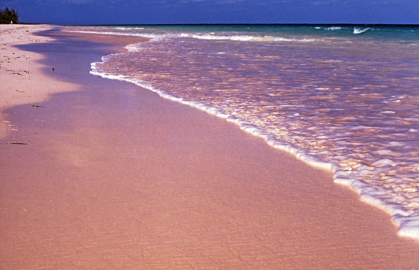
Three-plus miles of blush-pink sand, 50–100 ft wide, with an offshore reef that keeps the water calm, shallow and clear. The pink comes from crushed red foraminifera shells mixed into coral sand — strongest at the waterline and in early-morning light.

Getting there: Water taxi from Three Island Dock (North Eleuthera), then ~5 min by golf cart from Dunmore Town. Multiple public access lanes; the beach is public.

Open in Google Maps →

02Lighthouse Beach

South Eleuthera · Bannerman TownAtlantic + Caribbean pointWild beautyLong walksCliffs

Long regarded as Eleuthera's most spectacular beach — roughly 3 miles of soft sand, dunes, pink-streaked cliffs and the old skeleton lighthouse on the point. Still breathtaking, but access changed when Disney's Lookout Cay cruise stop opened in June 2024.

Getting there: Use the new public lot signed “Bannerman Beach Access” (a regular car can make it — the old 4WD-only track is gone), then walk the sand ~2.7 miles to reach the point itself. Taxis run visitors down for about $20/person round trip.

Heads up: Access changed (2026): you can no longer drive to the point. The Disney cruise area is for ship guests only on port days; the shoreline below the high-water mark stays public under Bahamian law. Quietest on days with no ship in.

Open in Google Maps →

03French Leave Beach

Governor's HarbourAtlantic (reef-tempered)Pink sandSwimmingNear town

The mainland's signature pink-sand beach on Banks Road — soft sand, palms, and water that stays fairly calm for an Atlantic beach. Ranked the #1 Eleuthera beach on Tripadvisor, and Tippy's beach bar sits on the same stretch.

Getting there: Paved Banks Road, ~5 minutes from Governor's Harbour; public beach paths along the road.

Open in Google Maps →

04Ten Bay Beach

Palmetto Point / Savannah SoundCaribbean (Bight)FamiliesCalm waterSandbars

The classic postcard bight beach: wide white sand and warm knee-deep water that runs hundreds of feet out at low tide. Shaded in the morning, sunny in the afternoon — the island's best easy family swim.

Getting there: 0.4-mile dirt road off Queen's Highway, normally in decent shape for any car. Ample parking.

Open in Google Maps →

05Gaulding Cay Beach

North Eleuthera · Gregory TownCaribbean (Bight)SnorkelingCalm waterShade

Powder-soft sand and shallow, calm water with a small cay you can walk to at low tide — the easiest great snorkel on the island (sea stars, reef fish around the rocks). Casuarina shade gives it a private-beach feel.

Getting there: 1.1 miles past Glass Window Bridge; 0.2-mile sandy road off Queen's Highway (keep right at the fork), fine for a regular car. Daddy Joe's restaurant is across the road.

Open in Google Maps →

06Twin Coves Beach

North of Governor's HarbourAtlanticPhotogenicSnorkelingSeclusion

Two crescent beaches split by a narrow palm-topped spit meeting at a point — one of the most photogenic spots on the island, usually near-empty, with clear water for swimming and snorkeling.

Getting there: Paved then sand roads with a short walk at the end.

Open in Google Maps →

07Tay Bay Beach

North Eleuthera · Preacher's CaveAtlantic (north shore)HistorySeclusion

Long, powdery sand steps from Preacher's Cave, where the shipwrecked Eleutheran Adventurers sheltered in 1648 — a beach day and the island's founding story in one stop. The ship-killing Devil's Backbone reef lies offshore.

Getting there: From North Eleuthera airport: ~1.5 mi west, 6 mi north, then a signed dirt road (~1.7 mi). A regular car is OK, taken slow.

Open in Google Maps →

08Ben Bay Beach

North EleutheraAtlantic (sheltered cove)Hidden gemCalm waterSnorkeling

A tiny horseshoe cove whose narrow mouth keeps it clear and calm even when the Atlantic is rough. Even sandy bottom, snorkeling along the rocky arms — a true hidden gem, if you can find it.

Getting there: Unmarked, overgrown dirt track with multiple forks; locals' directions help (right, then left–right–left). A big puddle sometimes means parking and walking the last stretch.

Open in Google Maps →

09Surfer's Beach

Gregory TownAtlanticSurfingScenery

The Bahamas' most famous surf break — about 2 miles of sugary sand where Atlantic swells wrap in, with a surf scene running since the 1960s. Best waves roughly October–April. A surf beach, not a swimming beach.

Getting there: Rough, rutted dirt track (“Ocean Boulevard”) off Queen's Highway ~2 mi south of Gregory Town — high clearance/4WD strongly advised, or park and walk 15–20 minutes.

Open in Google Maps →

10Rainbow Bay Beach

Rainbow BayCaribbean (Bight)Easy accessFamiliesSnorkeling

A sheltered cove with a clean sandy bottom and calm, warm shallows — the reliable plan B when the Atlantic side is rough, with good rock snorkeling on its left side.

Getting there: Paved road to a real parking area (Wandering Shore Drive, ~1 mile past the Rainbow Inn) — one of the easiest beaches to reach on the island.

Open in Google Maps →

11Alabaster Bay (Receiver's Beach)

Governor's Harbour / James CisternCaribbean (Bight)FamiliesCalm waterPaddleboarding

A powdery white-sand bay with warm, very shallow water far out — top-tier family swimming with shade trees, and a favorite for paddleboarding.

Getting there: Paved road ~0.1 mile off Queen's Highway; easy parking.

Open in Google Maps →

12Airport Beach (Navy Beach)

James Cistern / GHB airportAtlanticLong walksSolitude

About 3 miles of fine, firm pink-tinged sand below the ruins of the old U.S. Navy base — usually deserted, and one of the island's best long-walk beaches. Swim with care: the north end has drop-offs and undertow.

Getting there: Paved Knowles Drive to the south end; look for the marked turn off Queen's Highway.

Open in Google Maps →

13Current Beach & sandbars

The CurrentCaribbean (Bight)SandbarsDrift snorkel

Soft sand and famous low-tide sandbars at the edge of Current settlement. Next door, Current Cut is one of the Bahamas' best-known drift-snorkel channels when the tide runs.

Getting there: Paved spur off Queen's Highway to Current settlement; beach at the settlement edge.

Open in Google Maps →

14Twin Sisters Beach

Just south of Glass Window BridgeCaribbean (Bight)SnorkelingPhoto stop

Named for the twin boulders standing in clear turquoise shallows, with casuarina shade and snorkeling around the rocks — the natural pairing with a Glass Window Bridge stop 0.4 miles north.

Getting there: Short sandy pull-off directly off Queen's Highway.

Open in Google Maps →

15Lover's Beach

North of Gregory TownAtlanticRomanceScenery

Soft golden sand backed by grassy dunes with big Atlantic surf rolling in — better for walking and watching than swimming.

Getting there: Short unpaved spur off Queen's Highway a few miles north of Gregory Town.

Open in Google Maps →

16Poponi Beach

North Palmetto PointAtlanticPink sandQuiet

Soft pink sand with reef-protected swimming and palm shade — the quieter continuation of the French Leave / Banks Road coastline.

Getting there: Dirt road with an uphill section; small parking area.

Open in Google Maps →

17Double Bay Beach

East of Governor's HarbourAtlanticSolitudeLong walks

Roughly 5 miles of powdery pink-tinged sand, firm underfoot, with rolling surf and near-total solitude — bring water and you'll likely have it to yourself.

Getting there: Paved causeway then about a mile of gravel/sand road; a regular car is usually fine in dry weather.

Open in Google Maps →

18Winding Bay Beach

Near Rock SoundAtlantic (protected bay)SwimmingKayaking

A 1.6-mile crescent whose deep curve keeps the water calm despite facing the ocean. A man-made channel at the north end connects to Half Sound for a lazy kayak drift.

Getting there: Paved road toward the old Venta Club, then a short stretch to the beach path.

Open in Google Maps →

19Whiteland Beach

South of Rock SoundAtlanticSnorkelingLocals' favorite

Reef-protected, sandy-bottom swimming beneath low cliffs with palms and dramatic rock formations — a consistent insiders' favorite in the south.

Getting there: Fish Road off Queen's Highway ~1.5 mi, then ~3 mi of dirt — high clearance recommended.

Open in Google Maps →

20Half Sound & The Point

Tarpum Bay / Winding BayAtlantic (lagoon + ocean)AdventureReefKayaking

A lake-like tidal lagoon opening to the ocean, mangrove snorkeling at its south end, and off “The Point” one of the healthiest close-to-shore reefs on the island.

Getting there: 2+ miles of deeply rutted track (30–45 min) — high-clearance vehicle essential — or kayak in from Winding Bay via the channel.

Heads up: The tidal current at the mouth is impossible to swim against. Snorkel the reef on slack tide, and treat this as a raw, unmanaged place.

Open in Google Maps →

21Spanish Wells Beach

Spanish Wells (St. George's Cay)North shore, reef-shelteredSwimmingLocal vibe

A half-mile of soft white sand with smooth dunes, clear turquoise water and gentle waves — the quiet, working-island alternative to Harbour Island, minutes away by ferry.

Getting there: Water taxi from Gene's Bay dock (North Eleuthera), then walk or golf cart.

Open in Google Maps →

22Girls Bank & the Lone Tree

Harbour Island (bay side)Caribbean (harbour side)Photo iconLow tide

Shallow low-tide flats on the harbour side, home to the Lone Tree — a hurricane-delivered driftwood trunk that became one of the Bahamas' most photographed landmarks. Wading, not swimming.

Getting there: Walk or golf cart from Bay Street, Dunmore Town; go at low tide.

Open in Google Maps →

23Cotton Bay Beach

South EleutheraAtlanticSolitudeHistory

Miles of pink-and-white crescent fronting the legendary former Cotton Bay Club, Pan Am founder Juan Trippe's retreat. Beautiful and usually empty — for now.

Getting there: Via the Cotton Bay estate roads off Queen's Highway.

Heads up: Construction era: ground broke in 2025 on a $200M Ritz-Carlton Reserve here (target 2027). The shoreline below high water stays public, but practical access through the development varies — ask locally before making the drive.

Open in Google Maps →

24Jack's Bay Beach

South EleutheraAtlanticPink sandTurtles

A long, wild pink-sand shore with reef fish for snorkeling and seasonal turtle nesting — now fronted by the Jack's Bay Club development (Tiger Woods short course; a Nicklaus course opening 2026).

Getting there: No paved road to the sand; expect a walk in from the road.

Heads up: The club treats the beachfront as private amenity space even though the shoreline below high water is public by law. Independent-visitor experience is mixed — verify access locally before sending your day on it.

Open in Google Maps →

25Windermere Island Beach

Off Savannah SoundAtlanticRoyal historyPrivate

Five miles of pink sand on the slender private island where Prince Charles and Princess Diana famously holidayed. Serene and undeveloped — and effectively off-limits unless you're staying there.

Getting there: Single bridge with a 24-hour security gate; entry is limited to residents and homeowner guests. Renting a Windermere home is the practical way in.

Included for completeness — book a Windermere rental if this beach is the goal.

Open in Google Maps →

Questions people ask

Are beaches in Eleuthera free and public?

Yes. Under Bahamian law the shoreline below the high-water mark is public everywhere. A few beaches sit behind private developments (Windermere Island, and practically speaking Jack's Bay and Cotton Bay during construction), where reaching the sand is the complicated part — the sand itself isn't.

Is Lighthouse Beach still open in 2026?

You can still visit, but it changed. Since Disney's Lookout Cay opened (June 2024), the old 4WD track to the point is gone. Use the public “Bannerman Beach Access” lot — reachable by regular car — then walk about 2.7 miles of sand to the point. The cruise-guest area is off-limits to independent visitors on ship days; the shoreline itself remains public.

What is the best beach in Eleuthera?

For calm-water swimming: Ten Bay. For the postcard: Pink Sands on Harbour Island. For wild beauty worth a hike: Lighthouse Beach. Tripadvisor's current #1 is French Leave in Governor's Harbour. The honest answer is that the best beach is the one on the calm side of the island that day.

Do I need a 4WD or jeep to reach these beaches?

For most, no — Ten Bay, Rainbow Bay, Alabaster, French Leave, Gaulding Cay and Twin Sisters are fine in a regular car. You'll want high clearance for Surfer's Beach, Whiteland and Half Sound. Lighthouse Beach's new access lot is now regular-car friendly.

Which beaches have pink sand?

Pink Sands Beach on Harbour Island is the famous one — the color comes from crushed red foraminifera shells. On the mainland, French Leave and Poponi (Governor's Harbour area) and Jack's Bay in the south show real pink. Lighthouse Beach is mostly white-powder sand with pink-streaked cliffs, despite what some blogs claim.

When is the best time to visit Eleuthera's beaches?

Any month — that's the two-coast advantage. December–April brings the driest weather and the biggest Atlantic surf; summer is calmer and hotter. Whatever the wind is doing, one coast is usually flat.

Sources & verification notes

GO Eleuthera verifies against official Bahamian sources, local press and on-island checks. Spotted something out of date? Email info@surfstung.com — we fix it fast.

Plan the rest of your trip

More island guides